

DamSAR™ - 2 Year Sentinel-1 Screening
Introducing the most affordable site-specific InSAR screening on the market!
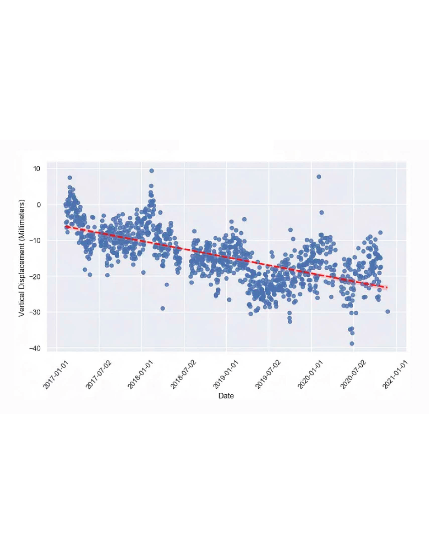
From the efficiencies of processing state-wide InSAR data, we are now able to offer a two-year InSAR screening analysis of your dam. Our service goes beyond raw deformation data by including a comprehensive interpretation summary from a licensed civil engineer with extensive experience in dam safety analysis. This interpretation allows you to understand the technical details of the analysis to enhance the safety and longevity of your dams.
In partnership with KorrAI.
Let's work together to Make Dams Safer!
Deliverables:
Professional engineer review of data
Phone call with client to explain the data
Summary of screening analysis
Schedule:
Delivery of results and Teams call within two weeks of request.
Assumptions and Limitations:
Uses processed Sentinel-1 data.
Limited to two years of data within the past three years.
Deformation results are relative to the satellite's Line-of-Sight.
Results can vary based on construction activities, vegetation coverage, surficial water, surface roughness, and localized atmospheric conditions.
Assumes the dams area of interest is less than 6 square miles.
The InSAR image resolution is approximately 10 meters by 10 meters.
Data is processed using persistent scatterer methods based on open-source algorithms.
Non-altered data outputs are provided along with interpolated and filtered data sets if appropriate. Measured and inferred data are clearly differentiated.
Results are best suited for large area earthen and rock fill dams with rip-rap or other angular surfaces.
Dam Safety Services and KorrAI offer a Money-Back guarantee on the results if the dam is not suitable for InSAR.
If movement is suspected, field verification by the client or their designated consultant will be recommended and will be the responsibility of the client.
Dam Safety Services is not responsible for the overall stability of the dam.
Introducing the most affordable site-specific InSAR screening on the market!
From the efficiencies of processing state-wide InSAR data, we are now able to offer a two-year InSAR screening analysis of your dam. Our service goes beyond raw deformation data by including a comprehensive interpretation summary from a licensed civil engineer with extensive experience in dam safety analysis. This interpretation allows you to understand the technical details of the analysis to enhance the safety and longevity of your dams.
In partnership with KorrAI.
Let's work together to Make Dams Safer!
Deliverables:
Professional engineer review of data
Phone call with client to explain the data
Summary of screening analysis
Schedule:
Delivery of results and Teams call within two weeks of request.
Assumptions and Limitations:
Uses processed Sentinel-1 data.
Limited to two years of data within the past three years.
Deformation results are relative to the satellite's Line-of-Sight.
Results can vary based on construction activities, vegetation coverage, surficial water, surface roughness, and localized atmospheric conditions.
Assumes the dams area of interest is less than 6 square miles.
The InSAR image resolution is approximately 10 meters by 10 meters.
Data is processed using persistent scatterer methods based on open-source algorithms.
Non-altered data outputs are provided along with interpolated and filtered data sets if appropriate. Measured and inferred data are clearly differentiated.
Results are best suited for large area earthen and rock fill dams with rip-rap or other angular surfaces.
Dam Safety Services and KorrAI offer a Money-Back guarantee on the results if the dam is not suitable for InSAR.
If movement is suspected, field verification by the client or their designated consultant will be recommended and will be the responsibility of the client.
Dam Safety Services is not responsible for the overall stability of the dam.